MORE IN CATEGORY
ADVERTISEMENT
Residential Products Online content is now on probuilder.com! Same great products coverage, now all in one place!

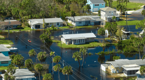
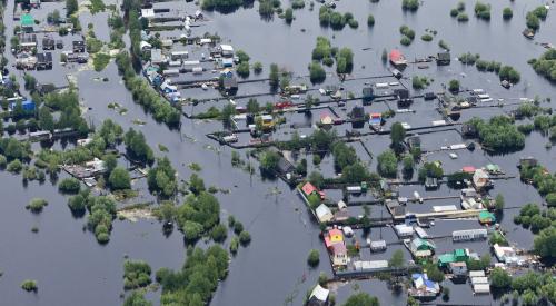
Recently released research shows nearly 6 million homes in the U.S. have a high risk of flooding that is not disclosed by federal flood maps. Realtor.com reports that research nonprofit First Street Foundation discovered 14.6 million properties fit into FEMA’s 1% annual flood risk areas, where federal maps only categorized 8.7 million properties. Although the numbers differ, FEMA says the nonprofit’s numbers complement theirs by depicting different types of risk. First Street Foundation’s maps are free to the public and show predictions for flood risk changes in the next 30 years.
Nearly six million properties across the U.S. have a substantial risk of flooding that isn’t disclosed by federal flood maps, according to a nonprofit research firm that released its own U.S. flood maps Monday.
The maps from nonprofit First Street Foundation highlight the widespread nature of flood risk. Flooding caused about $17 billion in property damage a year from 2010 to 2018, according to the Association of State Floodplain Managers.
Homeowners, developers and city planners have long used the Federal Emergency Management Agency’s flood maps, which outline flood zones. FEMA’s maps label which properties have at least a 1% annual risk of flooding, also called a 100-year flood zone.