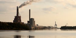
More than 17 million homes, at a combined estimated market value of $4.9 trillion, are located in areas that have considerable risk of environmental hazards.
ATTOM Data Solutions released its third annual Environmental Hazards Housing Risk Index, which analyzes more than 8,000 U.S. ZIP codes containing a total of 68.1 million single-family homes or condos. Roughly a quarter (17.3 million) of the homes studied are in ZIP codes that have a high or very high risk of at least one of four environmental hazards: Superfunds, brownfields, polluters, or poor air quality.
Home values are higher in low-risk areas. The 50 million homes with no nearby hazards have a median value of $343,259, higher than the 15 million homes with one hazard ($292,619), 1.9 million homes with two ($231,654), 180,577 homes with three hazards ($181,650), and 3,642 homes with all four ($198,263).
Sellers in areas with no hazards saw gains of, on average, $69,448 on their home values since the last purchase—$13,000 more than sellers in ZIP codes with one hazard, $22,000 more than those with two hazards, and $39,000 more than those with three. A disproportionate share of homes near hazards haven’t regained their value since the recession. More than 15 percent of homes with three or more hazards are still underwater, compared with just 9.4 percent of homes with no hazards.
The cities with the highest Total Environmental Hazard Index values are: Denver; San Bernardino, Calif.; Curtis Bay, Md.; Santa Fe Springs, Calif.; and Fresno, Calif. The 95203 ZIP code in the Stockton-Lodi, Calif., market was the only ZIP code at risk from all four hazard categories.
